Reflections on India – Pt. 1
It has now been a few weeks since I returned from my most recent travels in India and China, but I haven’t really had a chance to sit down and write much about this trip, apart from what I was writing at the time in my travelogue. For about a month and a half this summer I had the amazing opportunity to spend time traveling in two Indian states, Himachal Pradesh and Uttarakhand, as well as a short return to Kathmandu in Nepal, as part of two different related research projects for the research institute I work for, the India China Institute.
My first leg of the summer trip began with a visit to the town of Shimla, located in the Indian Himalayas in the state of Himachal Pradesh. Shimla was the former British summer capital during the occupation of India, and today is one of the many hill stations dotting the Indian landscape. This first visit was part of a trip to bring together artists from India, China, Nepal and the US to think about issues related to climate change and the arts, and how artists from a range of practices and countries are trying to engage with these issues in their own practices and local context.
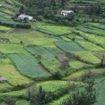
This trip to Shimla, which lasted about a week, was my first foray into the Himalayan areas of India, as well as the first time in Himachal Pradesh. Those familiar with India will likely find this reflection uninteresting, but the impression left on my as we drive north from Delhi towards Shimla was an exciting geographic panorama, as the flat plains of the area around India slowly give way to small hills, then suddenly the foothills transform into deep valleys and steep ridges. The entire shift struck me as rather abrupt, rather than one that was a gradual incline up higher and higher.
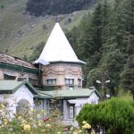
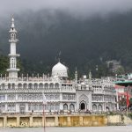
Sadly almost all of my pictures from this trip were lost when my camera and laptop were pilfered from my room in Kathmandu, but here is a small slide show of what Shimla looks like.
-

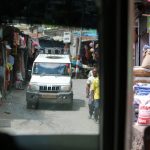
- The road to Shimla.
-
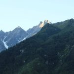
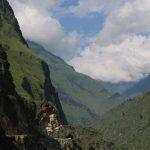
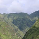
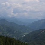
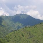
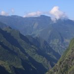
- A view of the Himalayas.
-
- Single-gauge train track leading to Shimla.
-
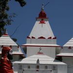
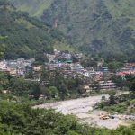
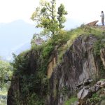
- The city on a hill.
-
- The city on a hill.
-
- The city on a hill.
-
- The city on a hill.
-
- Large clouds of fog like this are common in Shimla.
-
- The city on a hill.
-
- The city on a hill.
-
- The city on a hill.
-
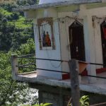
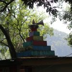
- A closer look at some of the houses in Shimla.
Overall the meetings in Shimla were a success. For those interested in learning more about the intersections of the arts and humanities in the Himalayas, you can learn more on the India China Institute’s website about the projects we have going on in this area.
After spending a week or so in Shimla, I headed back to Delhi, and then departed for Nepal for a quick visit to see some friends there, and I hoped, also sneak in some extra fieldwork time. Since part of my current dissertation research is focused on Nepal and the political situation there, particularly social movements and the draft (now approved) constitution process, I was excited about getting the change to go visit there while the constitution was still being debated and formed. Since that is a separate story, I will just note here that a future post (or two) will discuss my time in Nepal, so stay tuned for that.
After returning to India from Kathmandu it was time to head back into the mountains of northern India, this time to the Indian state of Uttarakhand, and along the India-Nepal border area. Our goal this time was quite different from the earlier visit. During that trip we were meeting with various artists and spending time thinking about climate change and the arts, and the pace and setting was fairly leisurely.
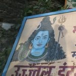
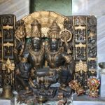
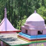
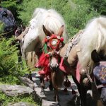
This trip would have us on the move constantly, with very little in the way of free time, much less leisure. Our goal was two-fold. The first goal was to follow the famous pilgrimage routes in India leading to Mount Kailash and Lake Manasarovar in Tibet, two interlinked and important religious sites for five religious traditions in the Himalayas–Buddhist, Hindu, Sikh, Jain and Bönpo, and try to understand a little better some of the dynamics at play in this region related to the intersections of religion and ecology. The second goal was to think about what questions and more research we would want to do the following year when our post-doc researcher and a small group of Indian and US researchers would be returning to the region for further research. In this sense the trip was one part exploration and one part field research.
For this trip we would not be going all the way to Tibet, but rather following the Indian pilgrimage routes as far as we could given our limited time and permit issues within India. Without going into a long story here, suffice it to say that because of historical border tensions, as well as current political issues, it is very difficult for foreigners to get permission to enter the “Inner Line” border area of India due to disputed boundary demarcations between India, Nepal and China. Even after spending several months in advance trying to secure permits, in the end only the India and Nepal members of our research group were able to go into the higher areas closer to the disputed border area.
Having done a similar trek last fall in Nepal, which also followed religious pilgrimage routes headed to Kailash and Manasarovar, it was quite instructive to see just how different the two border areas are on a variety of levels. From the type of travelers and the reaction from locals to the physical and cultural dynamics from village to village, the two trips really felt like they were worlds apart for me, even though we were ostensibly studying similar phenomenon (religious pilgrimage routes to Kailash). But to really get into these differences and observations would take a much longer post, which I hope to do–either as a post or a short academic article–in the coming months. So for now I will just say that the two areas are wildly different, and further research would be required to make sense of how and why these differences play out in a common landscape.
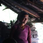
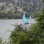
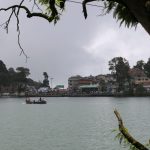
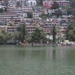
Our trek took us from Delhi to Karkodam, then to Nainital, and then east to Pithoragarh and up the border along Dharchula, Gala and Budhi, with one group making it all the way to Garbyang, which is the first village within the Inner Line border area. The first leg of the journey was by bus to Karkodam, and then from there east in Bolero jeeps, the most common mode of transportation there once you really get into the serious mountain areas. Then at a certain point (Narayan Ashram) we disembarked and began our hike on foot. We would spend about a week on foot in the area between Darchula and Garbyang.
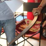
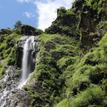
I’m still going through all of my photos, so I have not had enough time to really synthesize and distill my photos from this second India trek. However, here are a few randomly selected photos from along the way, just to give you a little sense of what my journey was like.


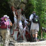
-
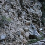
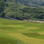
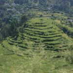
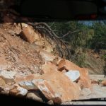
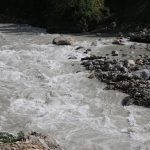
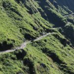
- A narrow mountain pass in Uttarakhand, India.
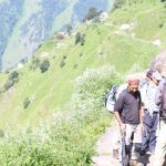


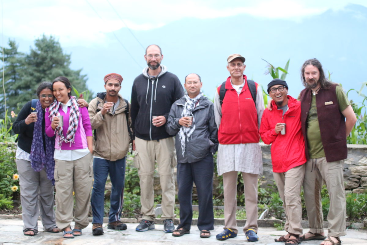
I’ll be writing more about the trek in the next post (pt. 2), so for now I will just end here by saying that this was an extremely exciting trip, and a very different one from my last two trips to India. Part of this has to do with the setting in the Himalayas. Another likely has to do with the topic being studied, as well as the group I was traveling with–a wonderful team of folks. Here is a group picture of our core team at the Narayan Ashram, the day before we began our foot trek into the mountains.
 That’s it for now. Stay tuned for my next post following up on details of our trek in India.
Until next time… seize the day.
###


And nothing concerning the devastation of the major earthquakes in Nepal. Some 600,000 homes were destroyed.
Hi Hoy, thanks for your comments. Since this post was focused on India, I didn’t discuss Nepal at all. But I will talk about my observations on the post-earthquake Kathmandu, and how it compared to my visit in the fall of 2014 before the earthquake, in the next post on Nepal. So check out that follow up post soon!